MapBiomas Uruguay
  • About MapBiomas
    • The Project
    • Products
    • About us
    • Team
    • Other initiatives
    • Terms of use
  • Maps and data
    • Access the platform
    • Statistics
    • Downloads
    • Accuracy analysis
    • Terms of use
  • Method
    • Methodology Overview
    • ATBD - step by step
    • Tools
    • Glossary
    • Terms of use
  • FAQ
  • Communication
    • Collection launch
    • Artículos MapBiomas
    • Videos
    • Brand guidelines
    • Terms of use
  • Contact
User
MapBiomas

Downloads

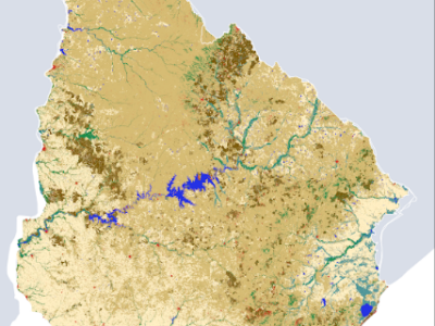
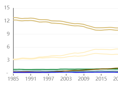
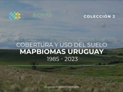
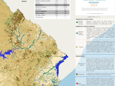
Download here maps, statistical data, Landsat image mosaics, legend codes and descriptions, among other data and communication materials from the MapBiomas Uruguay Collections.

Collection Maps

Uruguayan annual maps of LULC of MapBiomas.

Statistics

MapBiomas Uruguay map statistics database

Legend Information

File with the codes of the legend classes that appear in the raster files of the MapBiomas Uruguay Collections.

Fact sheets

Key data and information about land use and land cover dynamics in Uruguay

Infographics

Graphic materials with data on the evolution of land cover and use in Uruguay between 1985 and 2023.

Mural Map

Detailed maps of land cover and land use of Uruguay in 2023.

Landsat Mosaics

Landsat satellite image mosaics since 1985.

Reference maps

References from various organizations used in the classification.

Provided by Seeg

Powered by Google earth engine

© 2025 MapBiomas. All rights reserved.

Language

Development EcoStage